I am a dedicated GIS graduate with a Master's degree from the University of Glasgow, specializing in geospatial analysis and web mapping technologies. My academic journey has equipped me with comprehensive skills in spatial data analysis, cartography, and modern web development.
Through various projects and internship experiences, I have developed expertise in tools like ArcGIS, Mapbox, and web technologies including HTML, CSS, and JavaScript. I'm passionate about leveraging geographic information systems to solve real-world problems and create meaningful spatial insights.
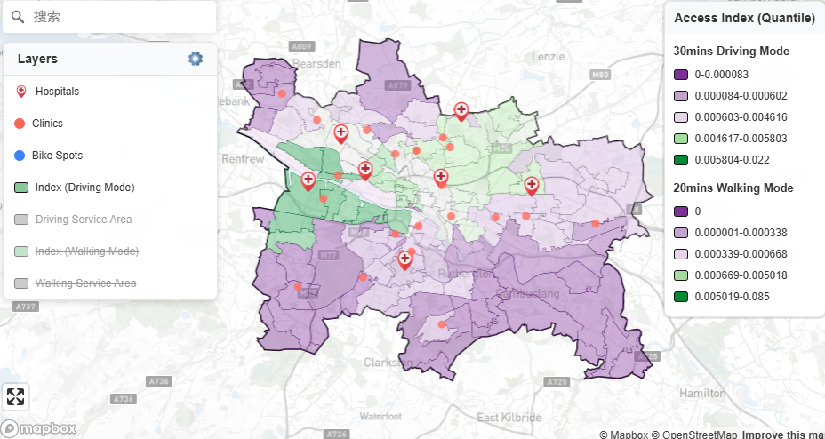
Accessing spatial accessibility to healthcare facilities in Glasgow using two-step floating catchment area (2SFCA) method. Project steps involve data collection, data preprocessing, network analysis, 2SFCA calculation, web design and web map creation.
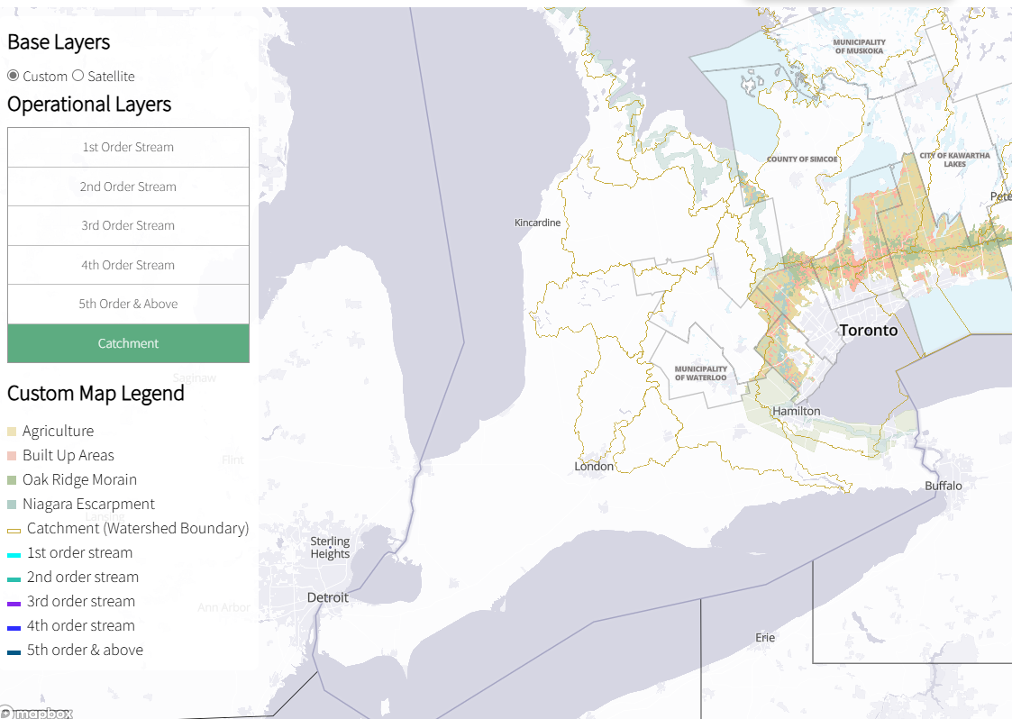
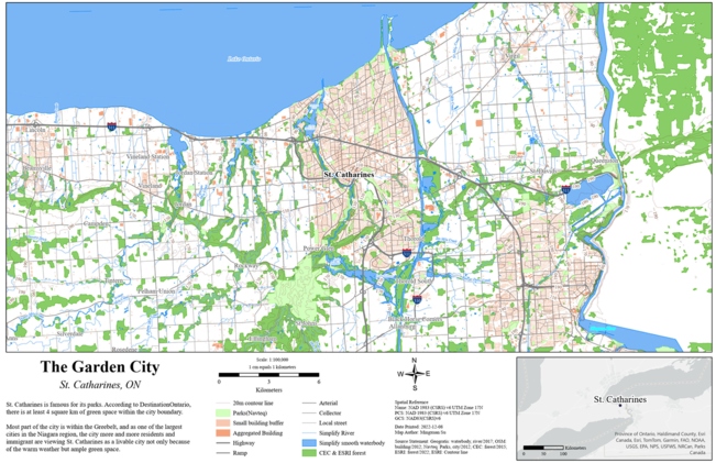
Analyzing and visualizing watershed boundaries, stream order, and land use in the Greater Golden Horseshoe region for our client (Ontario Headwaters Institute).
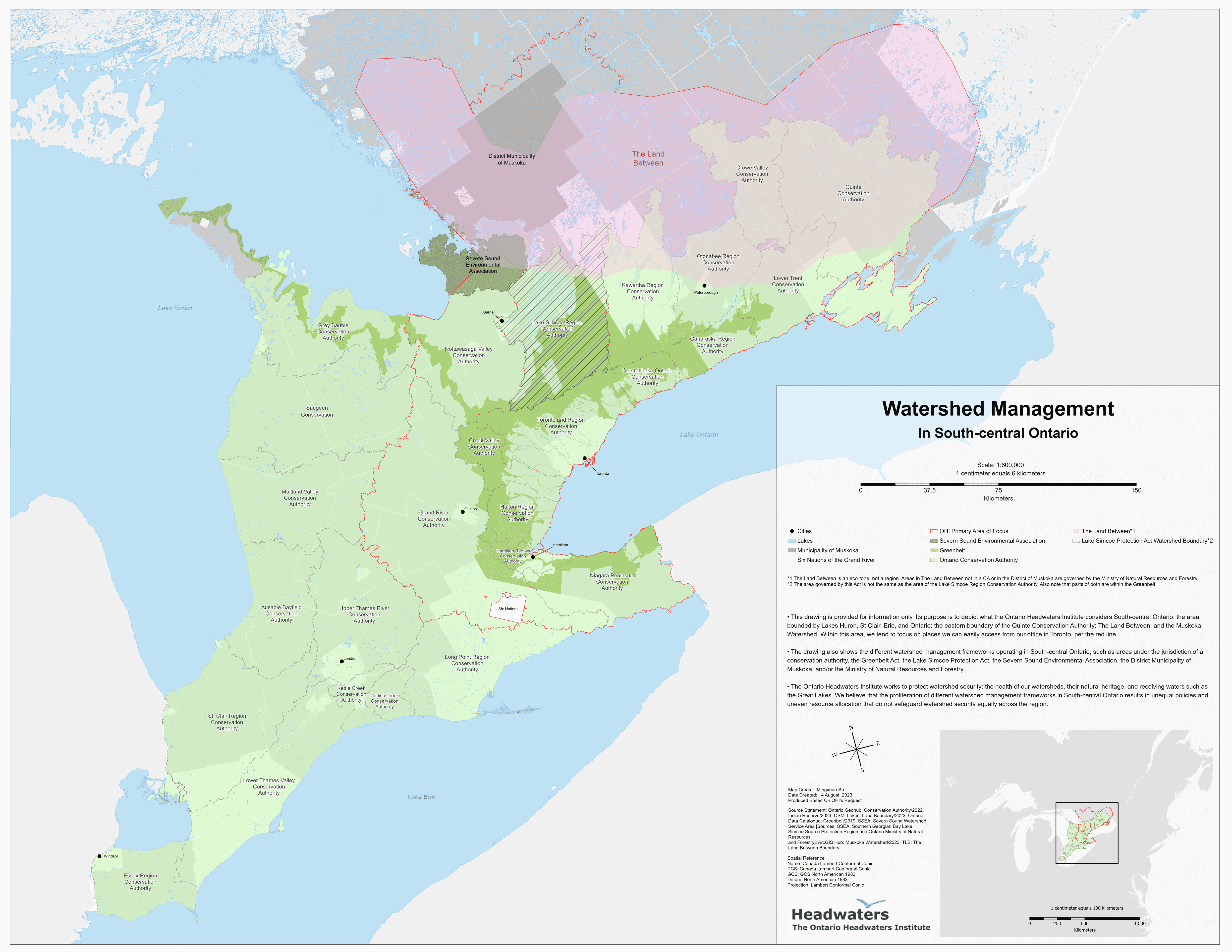
Performed spatial analysis and produced maps in accordance with client requests.
Municipal task, supervised by university professor
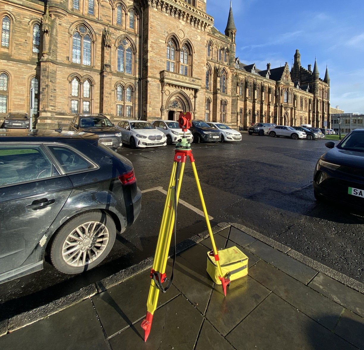
Conducting a land survey project and processing survey data in the lab
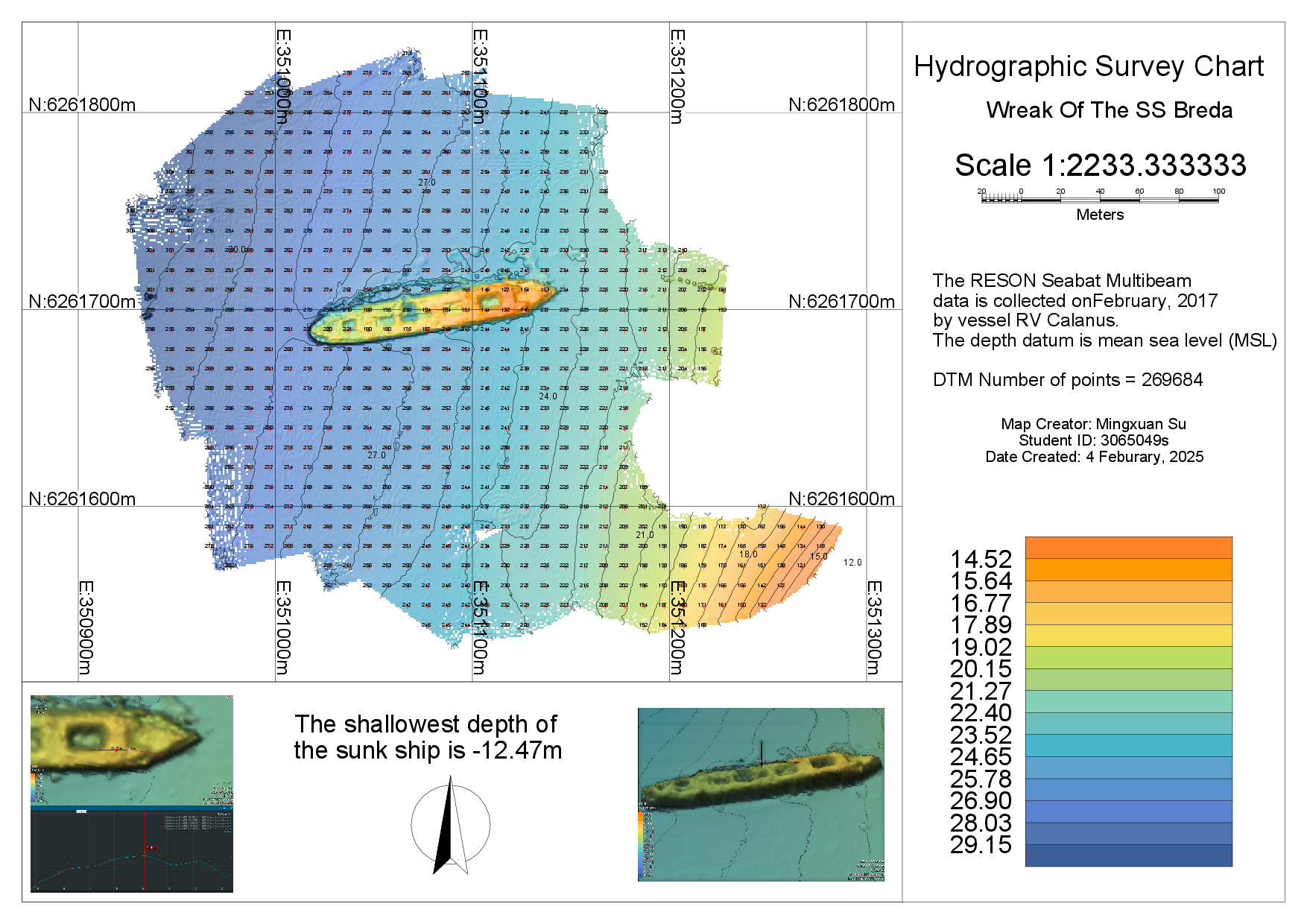
Calculating underwater sound velocity using multiple formulas, processing multibeam bathymetric data (noise removal), and visualizing results with NaviModel Producer.
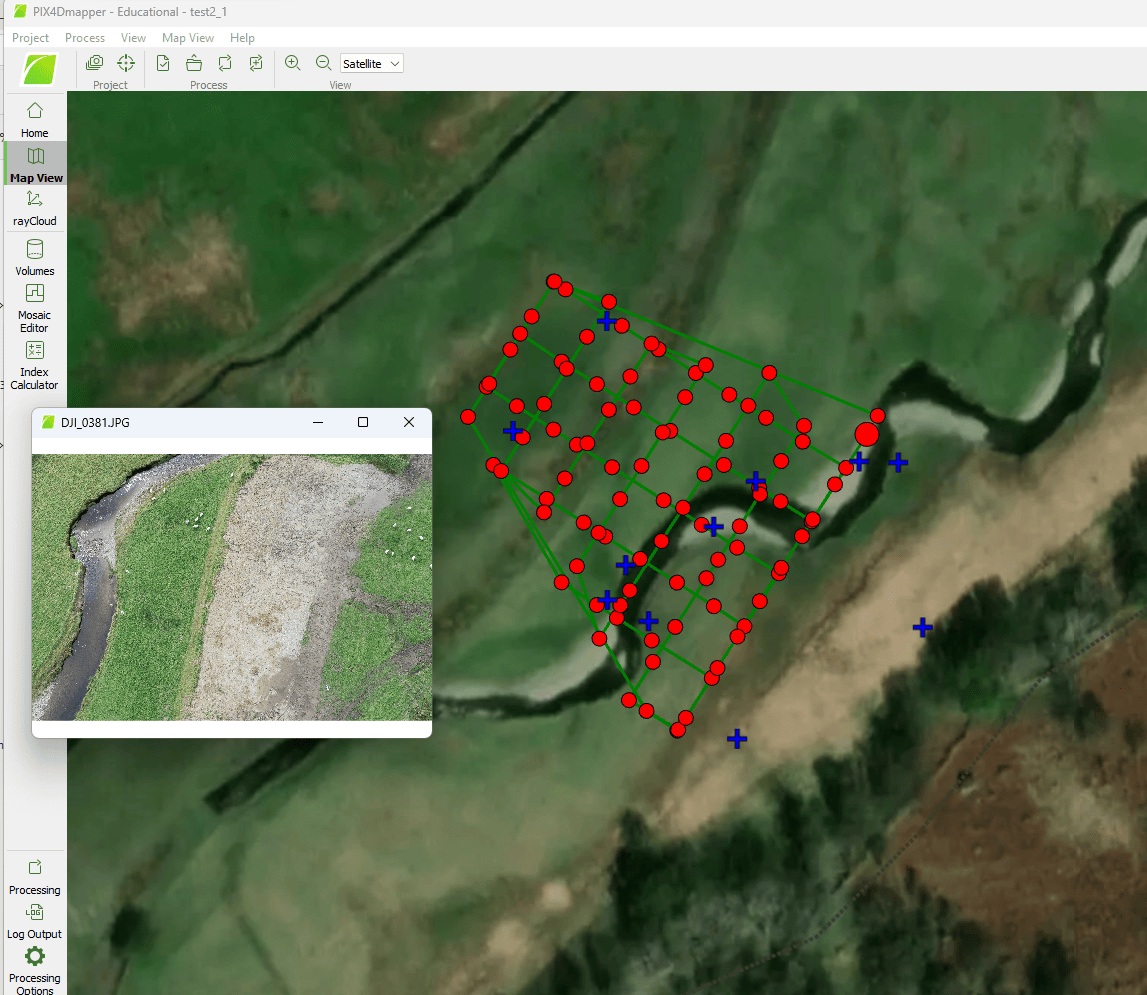
Drone data processing
LULC Map
3D elevation map
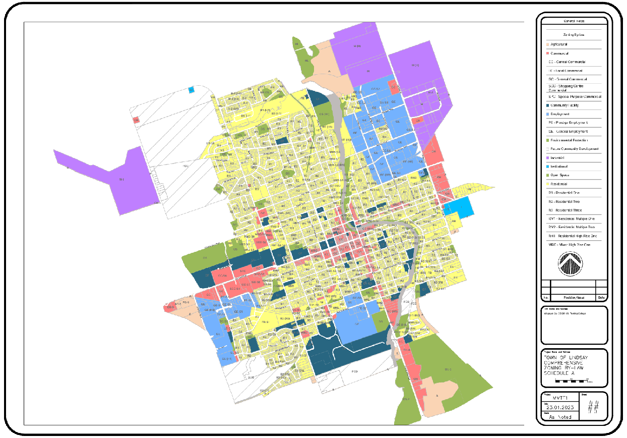
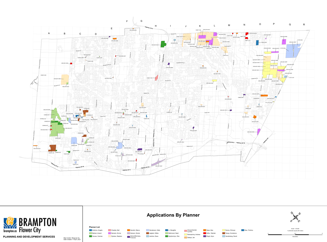
Municipal Mapping