Problem Statement
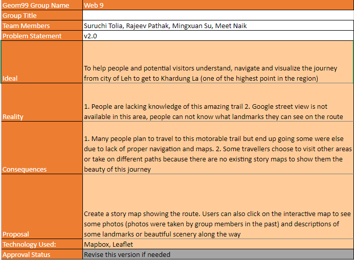
Group Number: 9
Team Members: Mingxuan Su, Suruchi Tolia, Rajeev Pathak, Meet Naik
Problem Statement: 2.0
Ideal: To help people and potential visitors understand, navigate and visualize the journey from city of Leh to get to Khardung La (one of the highest point in the region)
Reality: 1. People are lacking knowledge of this amazing trail 2. Google street view is not available in this area, people can not know what landmarks they can see on the route
Consequences: 1. Many people plan to travel to this motorable trail but end up going some were else due to lack of proper navigation and maps. 2. Some travellers choose to visit other areas or take on different paths because there are no existing story maps to show them the beauty of this journey
Proposal: Create a story map showing the route. Users can also click on the interactive map to see some photos (photos were taken by group members in the past) and descriptions of some landmarks or beautiful scenery along the way
Proposal: Mapbox (abandon, it's not completely free any more), Leaflet
Approval Status: Approved current version
